
HURRICANE FLORENCE: The latest updates as first bands reach shoreline
Sumter, Clarendon and Lee counties under tropical storm warning, flash flood watch
Stay tuned here for updates on Hurricane Florence as they come in, including preparations and possible impacts in Sumter, Lee and Clarendon counties.
5 p.m.
Sumter, Clarendon and Lee counties are all now under a tropical storm warning and flash flood watch as Hurricane Florence continues it slow approach toward the Carolinas and its rain bands bring water and rain to the coast of the Carolinas.
A tropical storm warning means tropical storm-force winds are expected within the next 36 hours, according to the National Weather Service.
The latest forecast for Florence from the agency’s National Hurricane Center says there is a potential for winds between 58 and 73 miles per hour.
“Plan for dangerous wind of equivalent strong tropical storm force due to possible forecast changes in track, size or intensity,” the 4:47 p.m. warning says. “Some damage to roofing and siding materials, along with damage to porches, awnings, carports and sheds.”
People in mobile homes should be cautious in the storm, especially if they are unanchored.
The flash flood watch warns of peak rainfall between 6 and 10 inches with locally higher amounts.
A tropical storm watch has been issued for Kershaw and Lancaster counties.
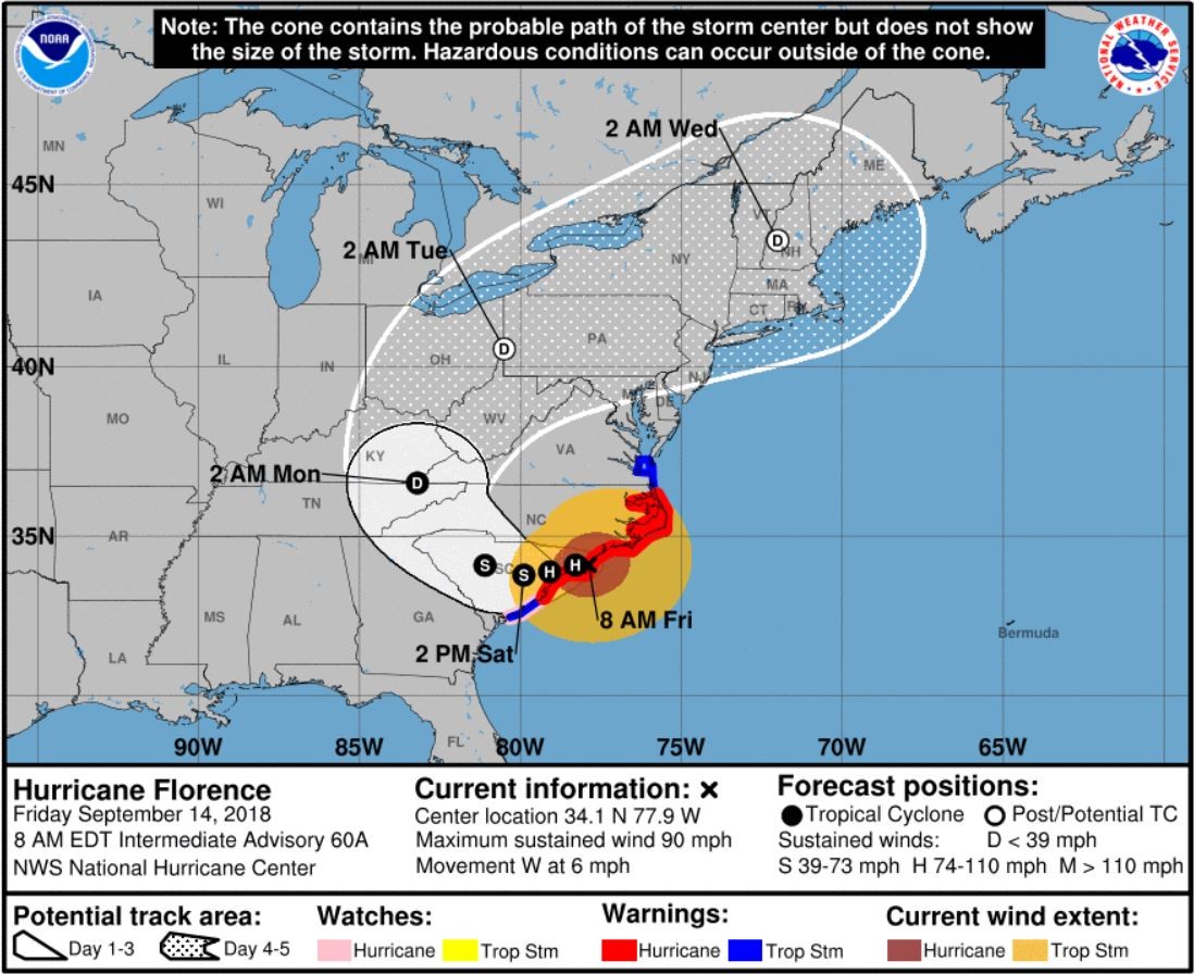
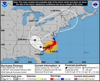
Florence is about 240 miles east of Sumter and is moving west-northwest at 5 mph with maximum wind speed of 100 mph.
The advisory says the worst conditions are expected Friday night into Sunday morning and that the largest threat will be from heavy rainfall causing flooding.
4:25 p.m.
U.S. Environmental Protection Agency Acting Administrator Andrew Wheeler approved on Thursday emergency fuel waiver requests made this afternoon on behalf of North Carolina Governor Roy Cooper and South Carolina Governor Henry McMaster.
The temporary waiver will help ensure an adequate supply of gasoline is available in the areas affected by Hurricane Florence until normal supply to the region can be restored.
EPA has waived the federal Reid vapor pressure requirements for fuel sold in designated areas in North Carolina and South Carolina to minimize problems with the supply of gasoline. This waiver will continue through Sept. 15, which is the end of the summer fuel season in these designated areas. EPA has also waived the prohibition on the blending of reformulated gasoline blendstock for oxygenated blending with other gasoline blendstock or oxygenate. This waiver of the comingling prohibition is effective through Oct. 1.
The Clear Air Act allows Wheeler, in consultation with U.S. Department of Energy Secretary Rick Perry, to waive certain fuel requirements to address shortages that could occur as a result of a hurricane.
1:50 p.m.
Sumter's Emergency Operation Center is preparing for 24-hour operations with tropical storm-force winds from Hurricane Florence expected to arrive in the Sumter area Thursday evening or Friday morning.
The EOC began 24-hour operations at 7 p.m. on Thursday, said Erik Hayes, director of the Sumter Emergency Management Office.
Personnel from the Sumter Fire Department, Sumter County EMS, Sumter Police Department, Sumter County Sheriff's Office, the local Department of Social Services office and American Red Cross were planning to arrive at the center before the storm does, he said.
Those officials, who are trained to work at this capacity, will be monitoring the storm and helping to answer emergency calls and coordinating response efforts before, during and after the storm, he said.
In these kinds of emergency situations, Hayes said, it is best to prepare for the worst and hope for the best.
Based on the latest reports from the National Hurricane Center the storm is going to pass through South Carolina, he said. But no one is certain if Florence will be a hurricane or tropical storm at that point, he said.
Sumter is expected to experience a tropical system of some kind, he said, though the severity is yet to be determined.
Hayes said Sumter will experience fast winds, and rain bands will bring periods of heavy and light rain. Power outages and downed trees are expected with any tropical system, he said.
Looking around town, Hayes said, it is evident that many Sumter residents have heeded the warnings from officials and are getting prepared for the storm.
If you do not have to be out during or after the storm, stay inside, he said.
Residents should stay away from doors and windows and stay in the most interior part of the structure they are using for shelter, he said.
Keep battery-operated flashlights and radios, medications, water and food on hand, Hayes said.
For those using generators, never operate them inside a structure, he said, and keep them outside in a well-ventilated area.
Hayes urged drivers to not drive through standing water during or after the storm to prevent stranding their vehicles and themselves, he said.
And be mindful of emergency personnel and line-workers when driving, Hayes said.
To monitor the storm, Hayes encouraged residents to go to the National Hurricane Center's website, if possible, or follow to trusted local news sources.
---
Law enforcement officials are asking residents to use their cell phones as little as possible during the storm to clear up the airways and save charges on devices.
Tonyia McGirt, public information office for the Sumter Police Department, said only use a phone in an emergency because there will likely be a higher-than-normal wave of people using the phone lines. Also, the more you use your phone, the lower the charge will go if there is no power, and a phone is vital to call for an emergency.
Noon
Sumter Mayor Joseph T. McElveen Jr. said in a statement about Hurricane Florence that local officials and first responders are meeting several times each day to review the forecasts and plan accordingly. He noted city employees’ work to clear out the storm water drainage system, especially “those areas that we know are subject to flooding.”
“I want to emphasize that the city, county, school district and our state legislative delegation are working together to assure that all resources we may need will be available,” he said in the statement. “At this time, plan for very strong winds and a significant amount of rain. You need to be prepared for both. The city is prepared to order evacuation in areas with a history of severe flooding. This will be done as a last resort and only for the purpose of saving the lives of those residents and our first responders.
“For those that may consider evacuation please gather important items that you may need to take with you. Suggestions are food, special diet items, pillow/blanket, special medications, baby formula and diapers if required. Please remember that pets, weapons and alcoholic beverages are prohibited in the shelters.
“If you have any questions, you may call our non-emergency line at 803-436-2700. As always, in case of emergency, please dial 911.”
11 a.m.
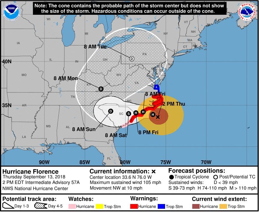
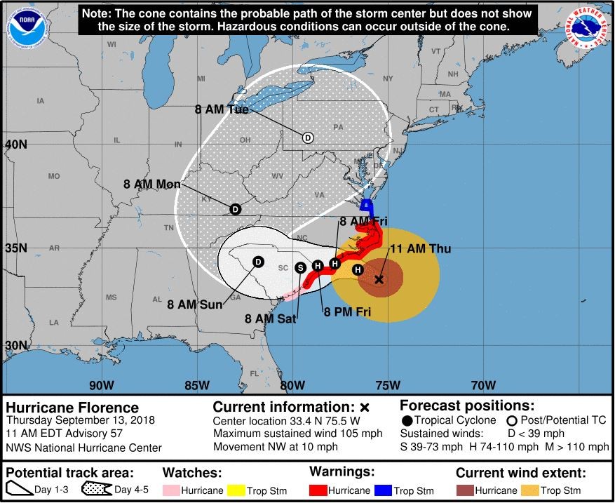
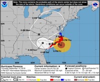
Heavy rain bands with tropical storm-force winds are spreading across the Outer Banks and coastal southeastern North Carolina, according to the 11 a.m. National Hurricane Center advisory.
The center of Florence is located about 195 miles east or Myrtle Beach with maximum sustained winds of 105 miles per hour. It is heading northwest at 17 mph.
8:45 a.m.
Shaw Air Force Base is now at Hurricane Condition 2 (HURCON2), which indicates winds of 58 miles per hour or greater are possible within 24 hours.
The change in HURCON follows Gov. Henry McMaster’s declaration of a state of emergency for South Carolina in preparation for Hurricane Florence.
Shaw is continuing to operate under mission-essential reporting duty status, which mean only mission-essential personnel should report for work through Friday.
The main gate will maintain normal operating hours through Friday. The 441 Gate and the Sumter Gate are closed to inbound and outbound traffic.
8 a.m.
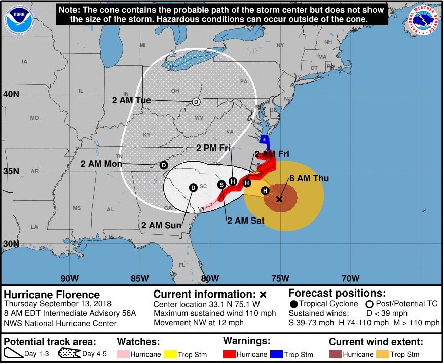
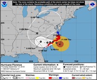
The first bands from Hurricane Florence, which has been downgraded to a Category 2 storm but has grown in size, are moving onshore of the Outer Banks of North Carolina.
According to the National Hurricane Center’s 8 a.m. advisory, the storm was located about 220 miles east of Myrtle Beach and is moving northwest at 12 mph with maximum sustained winds of 110 mph.
“Florence is a large hurricane. Hurricane-force winds extend outward up to 80 miles from the center, and tropical storm-force winds extend outward up to 195 miles,” the advisory said.
The cone of the storm continues to look like it will come ashore near the North Carolina-South Carolina border, head toward the middle of South Carolina and then make a turn back to the northeast.