
40 acres of wonder
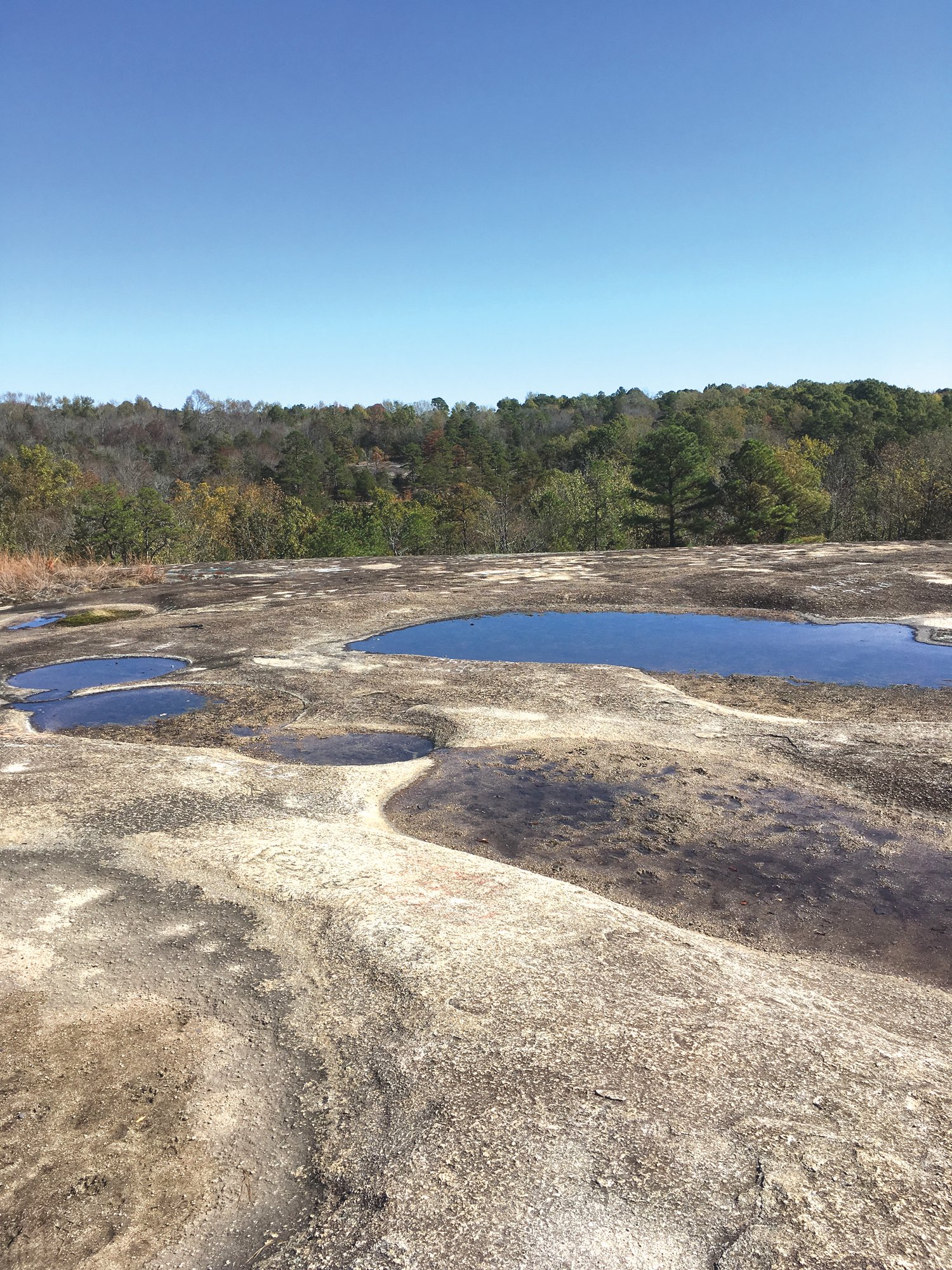
Pools of rain water collect on the Forty Acre Rock.
The upper trail was wide and sloped gently downhill. It was easy walking. Thick pine forest closed in on each side. The blackened trunks were evidence of a low-intensity prescribed burn. Dogwoods, post oaks and a few small sweetgums were scattered throughout the understory. A soft breeze whispered through the pine tops. The air was crisp and cool.
Just ahead an open area could be seen through the piney woods.
"There it is," I told Ginger.
The piney woodlands gave way to a scrappy stand of twisted cedars and stunted shortleaf pines. Big granite rocks and boulders were scattered about. A massive granite outcropping stretched out across the hillside before us, and a beautiful vista of ridges rolled out into the distance. We were standing at the top of Forty Acre Rock in Lancaster County.
Forty Acre Rock Heritage Preserve is a National Natural Landmark. The 2,267-acre preserve is blessed with a bounty of natural treasures to include waterslides, waterfalls, a beaver pond, caves, hardwoods and pine forest and a variety of wildflowers and wildlife. Granite flatrocks, including Forty Acre Rock, are at the heart of the preserve and are scattered throughout the property.
There are no campsites, restrooms, phones or other modern conveniences. If you visit the site, bring your own water, food and other supplies. There are no signage, maps or trail information at the lower or upper parking areas. Some information, including directions, can be found online. Forty Acre Rock is not actually 40 acres but measures 14.7 acres. My guess is that someone in the past must have looked at the massive flatrock and exclaimed, "This thing must be 40 acres."
Actually, it looks more like the surface of the moon than a rock formation. There are natural depressions all over the rock surface. Some are known as solution pools and do not hold rainwater very long. Other larger pools, known as vernal pools, hold water longer and offer habitat for a variety of endangered species.
William Gilmore Simms gave a description of the large exposed granite mass in his book Geography of South Carolina, published in 1843. It is thought that the Indians ground their corn in the hollowed pits on the rock's surface. One particularly large pit was known by the early settlers as "King Hagler's Punchbowl" after the Catawba Indian king, who was slain by the Shawnees in 1763. There is another marking on the rock that is called the "Devils Footprint."
Ginger and I walked over the gently sloping surface ignoring the spray-painted graffiti that is of such little consequence compared to the majesty and natural beauty of the place. We sat for a while on a natural shelf of the rock and gazed at the panoramic view of the hills in the distance. The colors on the hardwoods just beginning to turn. We marveled at this special place.
The preserve is only modestly used by the public, so people encounters are infrequent. We had arrived a little before noon, and there was only one other car at the upper trail head. While we lingered on the rock soaking up the view, a couple of hikers passed by. I vowed to return in the spring and walk the trails from the lower parking area.
Soon, we realized reluctantly that it was time to go and took the trail back to the upper parking lot, stopping along the way to examine the tiny cones of the short-leaf pines. Some as small as my thumb. Birds flitted through the brush, and crows called in the distance. The wind whispered overhead. The day had been a wonder.
Reach Dan Geddings at cdgeddings@gmail.com.