
Outdoor columnist Dan Geddings: Regarding maps
'How far in from here does the property go?" I asked. The answer surprised me. "I don't know." Then I asked, "What's on the other side of that swamp?" Again, the answer was, "I don't know." We were sitting in the truck along a rural road, and he was showing me the hunt club property. The property line was marked, and I decided I would return another day and walk the line to see for myself. Apparently, the club had no maps available of this timber company lease.
When I was a youngster, I had drawn maps of the land that we hunted. My drawings on notebook paper were based on my actual experiences of walking and riding over the land. The drawings were produced for my own use and interest. They were not to an actual scale or a factual rendition but were a visualization of how I thought the land was laid out. Actual property lines didn't really exist in my mind at the time.
Every Saturday morning during the deer season, a small crowd gathered at our house to put on a deer drive. When the crowd was assembled and we were ready to start a hunt, my Dad would usually take a stick and draw a crude map in the dirt to show where the standers would be posted and which way the hounds would be pushed. We had no maps of the hunting lands on paper.
Years later while I was working at the Highway Department, I was exposed to county maps while doing roadwork research. The maps were kept in the basement of the courthouse. They were copies of aerial photographs that were reproduced on large blueprint sheets. Property lines were drawn in by employees of the assessor's office and were not exact but only shown for information.
Anyone could visit the courthouse and look through the maps, and for a fee, a copy could be produced. I realized the maps would be valuable for hunt club use. Hunters could learn the lay of the land and could also know the property boundaries.
The hunt club that I had been shown needed maps, and after I joined the club, I started getting copies of the county maps. I taped together six big sheets and stapled them to a wall of the clubhouse. These sheets were an improvement and were not blue but rendered in black and white. Only a few counties had these maps available at the time.
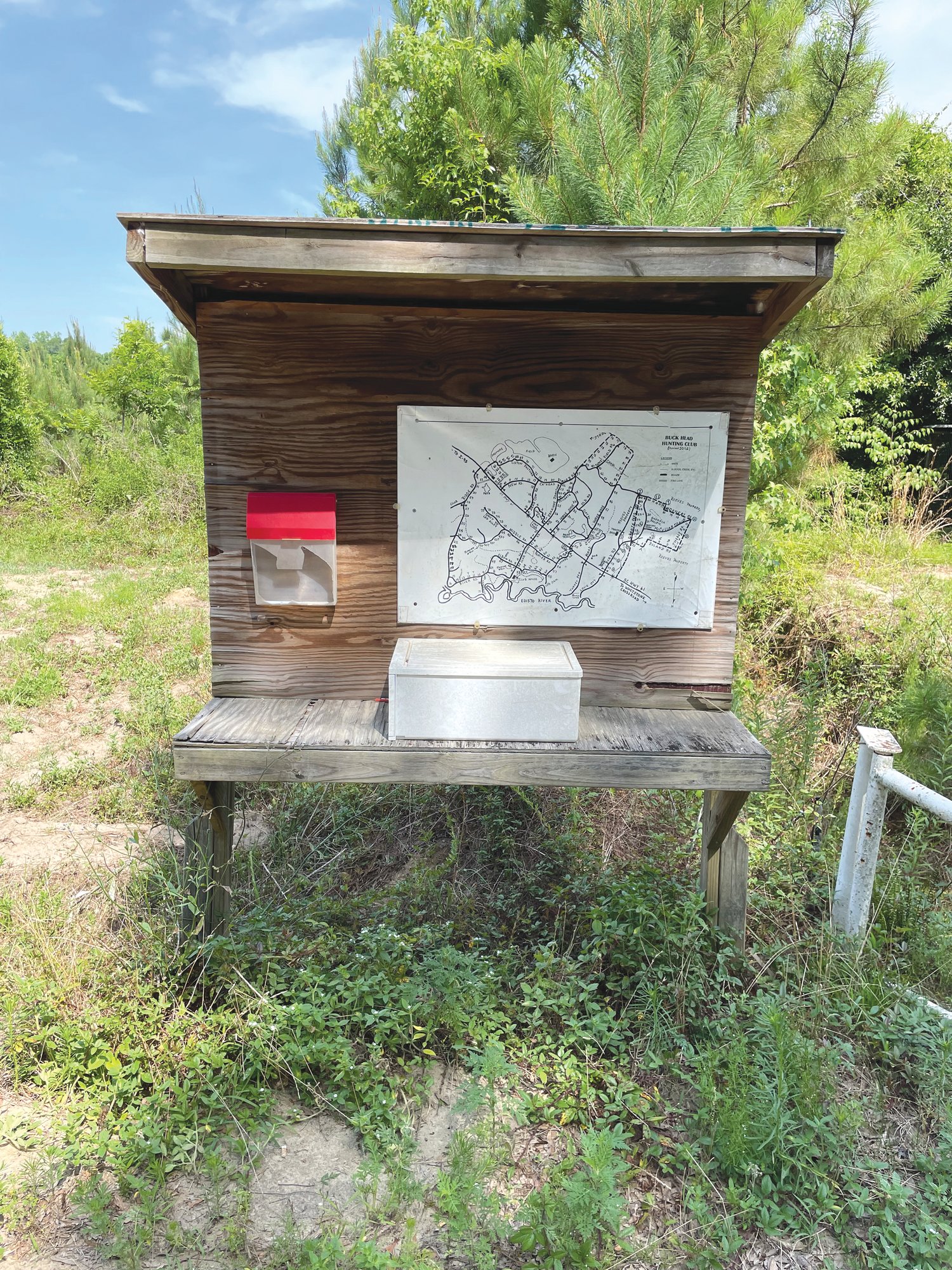
Eventually I joined a hunt club in the Lowcountry that had no county maps but had a very good hand-drawn map of the land that was made by a couple of the members. The map was enlarged and posted at the clubhouse. I made a copy and posted it on a kiosk that I built for the club.
I had also learned that surveyors mark the property lines through the woods with a bush ax or hatchet chop on trees. These are considered witness trees. Two chops are made on the side of a tree toward the line. Three chops are made at a corner or a turn. The chop marks are visible for many years. My brother Matt and I walked the Santee Cooper property line through the Santee/Wateree Swamp many years ago following the surveyor's chop marks. I had a hand-drawn map of the upper Santee Swamp and was curious about the actual location of the property line.
The county maps have improved in quality over the years and are in color now. They are updated every few years. I get them laminated and use them now to post at our hunting club.
In the last few years, technology has improved to the point where maps with property lines and aerial views are available on smartphones. Global Positioning Satellites can locate the user's position on the cellphone maps. The images are too small for my taste, but many younger hunters use them.
I have a collection of maps that I have used over the years. Most aren't needed anymore, but I just can't make myself throw them away. I might need them again someday.
Reach Dan Geddings at cdgeddings@gmail.com.