
Tropical Storm Ian updates for Sumter, Clarendon and Lee counties: Sept. 29, 2022
Editor's note: This article and all of The Sumter Item's hurricane coverage is free as a public service. We believe having access to reliable, accurate and up-to-date local information before, during and after inclement weather is critical to the vitality and safety of the communities we serve and that money should not be a barrier to that access. We do, however, rely on paying subscribers to support our independently, family owned business. If you value the local news you're reading and are not a subscriber, please consider becoming one today at http://theitem.com/subscribe.
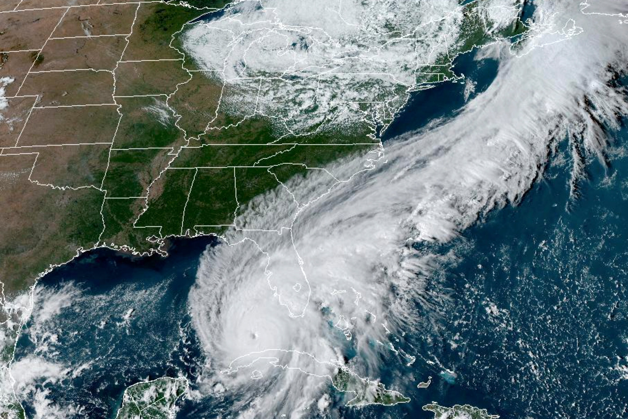
As Ian travels through Florida, the tri-county area is still under a Tropical Storm Watch.
As of 9 a.m. Thursday, Sumter, Clarendon and Lee counties are still under a Tropical Storm Watch. Ian is around 410 miles south of Columbia, and moving northeast at 8 mph, according to the National Weather Service in Columbia. The forecast continues to show cloudy skies and low temperatures in the high 60s. Wind speeds are expected to be 21 mph, and gusts of wind at 31 mph.
Tonight, temperatures are expected to drop to 59 degrees and showers are likely to begin around 4 a.m., continuing into Friday night. Levels of rain are likely to be between a quarter and half of an inch.
11:15 a.m.
Sumter County Emergency Management Director Donna Dew did not have additional information to provide at this time for Sumter County. She said staff is watching the National Weather Service forecast, which will be updated early this afternoon.
After the National Weather Service update, Emergency Management will meet with Sumter County Government and the City of Sumter to discuss further preparation plans.
12:23 p.m.
Sumter, Lee and Clarendon counties are under a tropical storm warning.
According to the National Weather Service, a tropical storm warning means tropical storm-force winds are expected within the area the next 36 hours. The peak wind forecast is 15-25 mph with gusts up to 45 mph.
The National Weather Service said affected communities should begin planning for hazardous winds that could damage outdoor porches, carports, sheds, unanchored mobile homes, a few trees uprooted and large tree limbs broken off.
Flooding rain has remained steady from the previous assessment –2-4 inches or peak rainfall amount.
Ian is about 360 miles south of Sumter, traveling at 9 mph.
1:15 p.m.
Gov. Henry McMaster will hold a media briefing on Hurricane Ian updates with state emergency management officials today at 4 p.m.
4:20 p.m.
As the tropical storm warning is still in effect, a flood watch has been issued for the tri-county area through Saturday.
According to the National Weather Service, the flood watch went into effect around 2:45 p.m. and is expected to last through Saturday morning. Excessive amounts of runoff may result in flooding of rivers, creeks, streams and other low-lying and flood prone locations. Residents living in areas prone to flooding should be prepared to take action should flooding develop, NWS said.
Heavy rainfall is expected to begin late tonight around 4 a.m. and continue throughout Friday, ranging between 3 to 5 inches.
Tropical storm conditions will continue throughout Friday, well into the night.
On Saturday, there is a 60% chance of showers, along with partly sunny skies and temperatures around 73 degrees. Wind speeds are expected to be between 8 to 10 mph with gusts of winds as high as 20 mph.
4:30 p.m.
Gov. Henry McMaster held a briefing at 4 p.m. Thursday where the National Weather Service announced that Tropical Storm Ian’s forecast trends expect Ian to “intensify back to a hurricane.”
National Weather Service COO John Murphy said the forecast has raised more concern, and Ian may be the first hurricane to make landfall since Hurricane Matthew in 2016.
McMaster said he has not made any state order to close offices or state of evacuation, but the storm is still something residents should be prepared for.
“It doesn’t make much difference if this comes in at hurricane strength or below a storm strength,” he said, “it’s going to be blowing strong winds.”
McMaster said Ian will also bring in a lot of water, especially along the coast, and come with “top strength” to South Carolina. The South Carolina Department of Transportation encourages South Carolina residents to remain off the roads Friday.
“We know this is going to be a serious storm,” McMaster said. “We’re not preparing anymore. We’re acting now. We know that we can handle this if we use our heads and follow the rules.”
Stay tuned here for updates on Hurricane Ian as they come in, including preparations and possible impacts in Sumter, Lee and Clarendon counties.
Shelbie Goulding and Alaysha Maple contributed to this article.