
Outdoor columnist Dan Geddings: A trip to the mountains
The two-lane road leads through the small town of Campobello, then on through open fields and pastures. The "Blue Wall" of the Blue Ridge Mountains rises up to the north. The road is South Carolina's Cherokee Foothills Scenic Highway. It is a treasure.
Ginger and I have made the trip every year for nearly a decade. When the wild grapevines turn bright yellow here, it's time to go. The hardwood foothills and mountains will be decked out in amazing colors.
The brilliant blue sky and clear mountain air, with the morning sun behind us, made the views stand out as we drove along in no particular hurry. There is much to see.
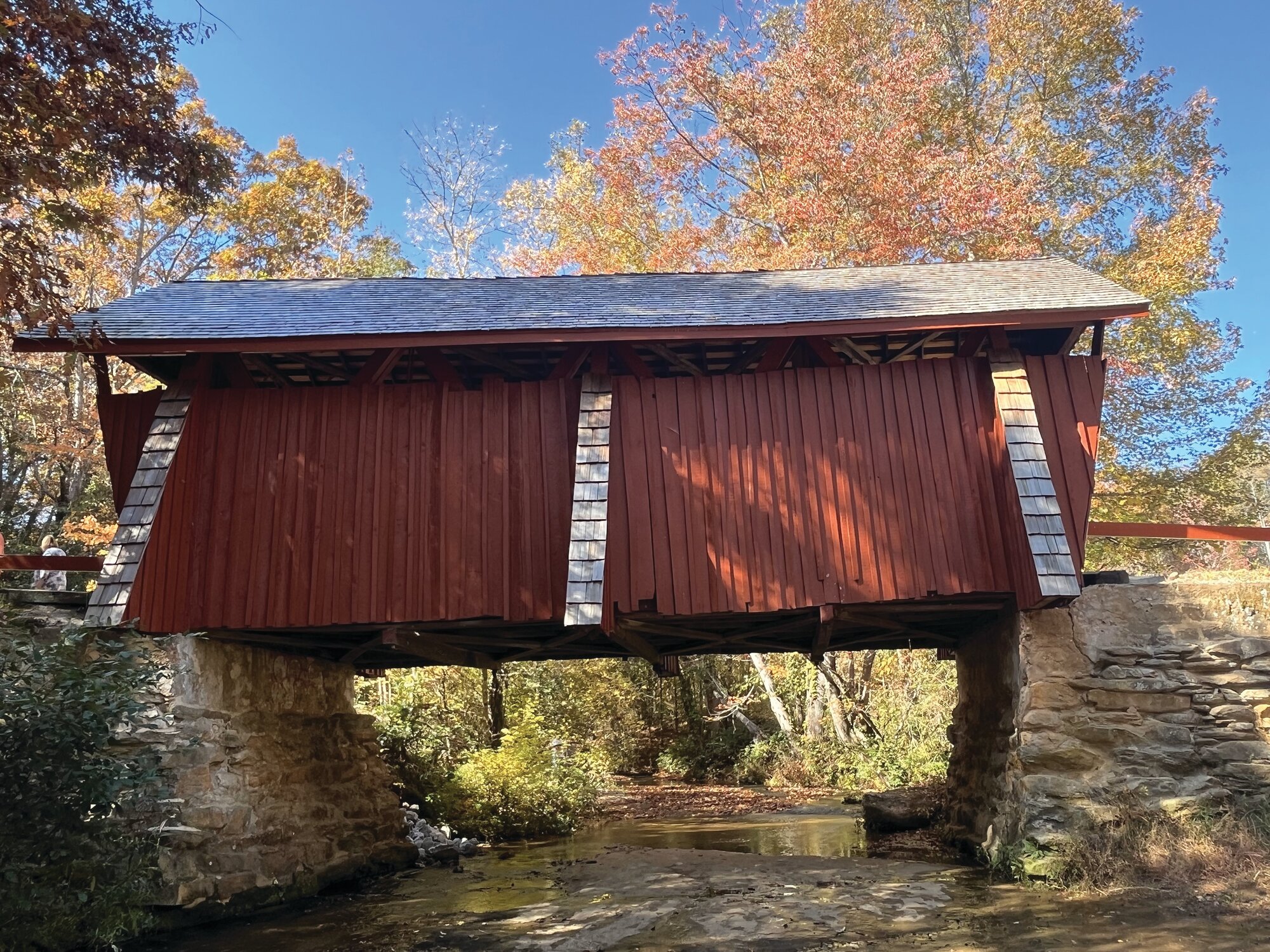
Our first stop was just a short detour to Campbells Covered Bridge. It is the only remaining covered bridge in South Carolina. The bridge was built in 1909 and was named after Alexander Campbell, who owned and operated a grist mill at the site for many years. The bridge measures 35 feet long and 12 feet wide. The timbers in the bridge are massive and are an excellent example of a four-span truss system with diagonal timbers and vertical iron rods.
The small parking lot was full, so we parked on the side of the entrance road. A short walk led down to the bridge. A shallow mountain stream running over smooth slabs of stone ran under the bridge. Small children ran barefoot through the cold water and the sandy-bottomed pools. The bridge isn't open to vehicular traffic but is open to a leisurely stroll of foot traffic. We took pictures and drank in the beautiful atmosphere.
Back on the road, we headed west and passed the turnoff to Poinsett Bridge - a site that we visited last year. Then through some beautiful foliage and past the Wildcat Falls, which is just off the side of the road. The scenic road itself is over rolling hills and is an easy drive through relatively wild country.
We pointed out colorful woodland copse to each other and marveled at the close-up views of the mountains. Eventually Table Rock loomed on the right. Its stone face is an unexpected delight in the land of forested mountains.
As we drove along, I had noticed a few pickups, some with dog boxes, parked at gated roads that led uphill into the mountains, and I told Ginger, "bear hunters."
We stopped at a roadside store and had a pulled pork sandwich for a late lunch. Then got back on the road. Traffic was a little heavier than what we had seen before but was still relatively light.
At U.S. Highway 178, we turned north and headed toward Sassafras Mountain, the tallest peak in South Carolina. This road gains altitude and climbs the mountains. There are stretches with sharp switchbacks where the speed limit is reduced to 20 miles per hour. It is not a section for the faint of heart, but it is exhilarating to drive and see. This road runs through the Jocassee Gorges, a 43,500-acre tract of mountain woodland.
We passed an area known as Rocky Bottom where a road leads up to the summit of Sassafras Mountain. It's a beautiful place that we have visited a couple of times. There is a hunt club here with hounds tied out in the yard waiting for the next bear hunt. After another section of sharp curves, switchbacks and steep grades, we decided to turn back. At the North Carolina state line, we turned around in a driveway and headed back.
The leaf colors in these mountains with the sunlight streaming through were so bright and beautiful that it seemed to be more than your mind could take in. We didn't take a single picture. We just marveled at the wonder of it all.
Highway 178 led us back to Highway 11, which is the foothills trail. We crossed and went on toward Pickens, a place we had not been to before. We wanted to take the "back way" home. The road took us through some new country, and at one point, I told Ginger, "Look back at the mountains." They were now a hazy blue in the distance. We were headed home but will be back.
Email Dan Geddings at cdgeddings@gmail.com.